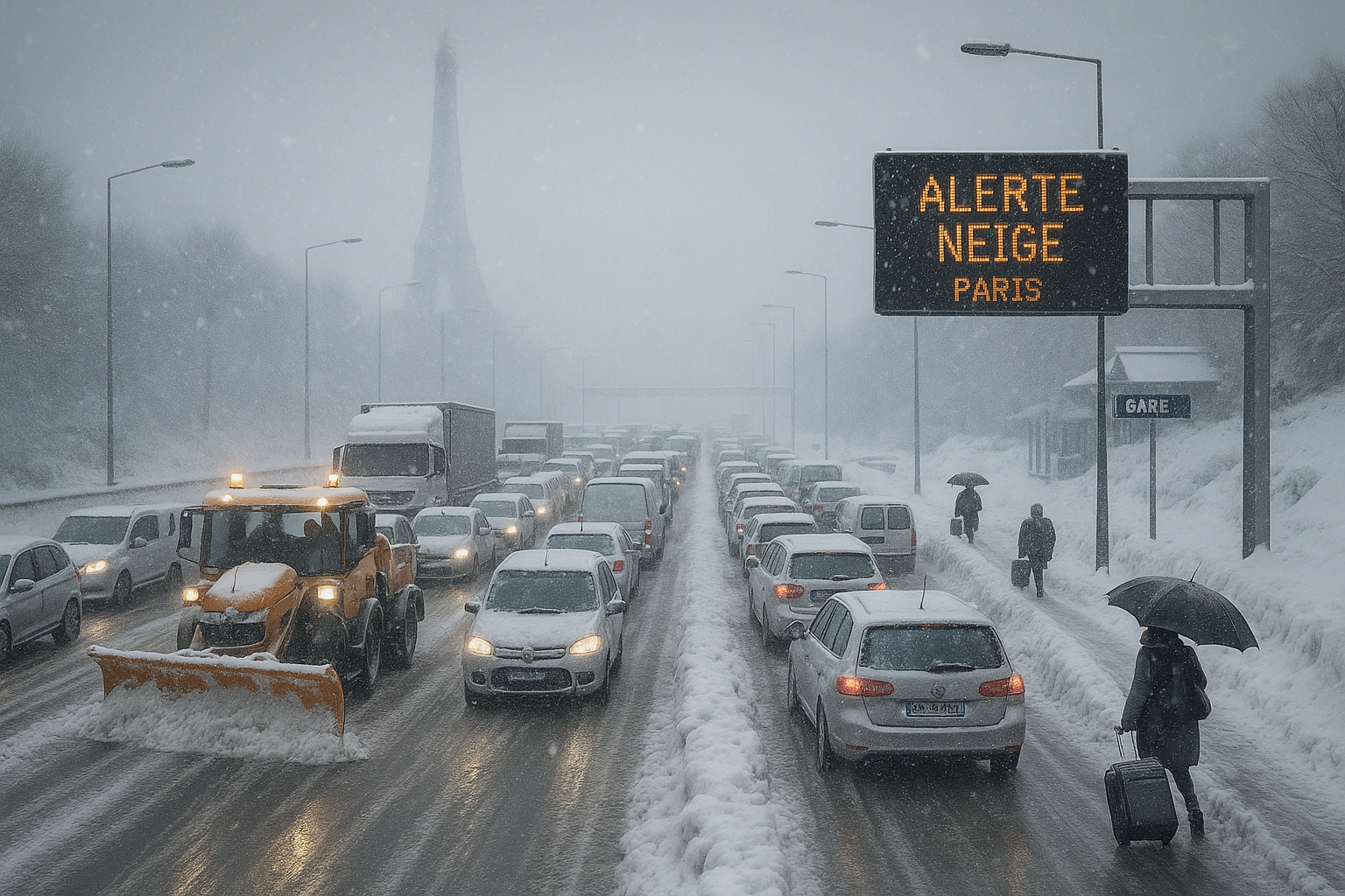
Snow-covered Paris highway gridlocked with stranded vehicles during France's intense cold wave, Eiffel Tower in snowy background.
Image generated by AI

France cold wave: Widespread transport chaos as snow blankets west and Paris region

Image generated by AI

Following initial alerts and school closures in western France, the polar cold wave intensified on January 5, 2026, blanketing the west and Paris basin with heavy snow. Twenty-six departments on orange alert faced massive road, rail, and air disruptions, with authorities warning of slippery roads persisting into Tuesday.

The cold wave, which prompted early suspensions of school transports in Brittany and Normandy, brought 2-3 cm of snow to Paris (up to 5 cm locally), 3-7 cm in Normandy (up to 10 cm on heights), and 5-10 cm in Brittany and Pays de la Loire, as reported by Météo-France.

Transport Minister Philippe Tabarot noted circulation would remain tricky until Tuesday morning. In Île-de-France, level 3 snow plan activated: speeds capped at 80 km/h, trucks over 3.5 tonnes banned. Nationwide, over 1,000 km of jams peaked at 1,020 km around Paris at 6 p.m. Paris buses halted from 4 p.m., RER lines slowed, TGVs limited to 200 km/h. Airports saw 15% flight cuts, delays of 50 min at Roissy and 37 at Orly.

Normandy's A28/A84 blocked by jackknifed trucks; minor bus accidents in Mayenne. School transports also suspended in several Île-de-France departments. Rouen farmers delayed protest.

Looking ahead, heavier snow forecast Wednesday in center-northwest. Sub-zero cold cuts EV range 20-50%; experts recommend preconditioning. Heavy frosts expected overnight, urging avoidance of non-essential travel.
What people are saying

Discussions on X highlight unprecedented transport chaos in Île-de-France with over 1000 km of traffic jams, RATP buses halted, and train delays from minimal snowfall. Users criticize poor anticipation, lack of road salting, and compare unfavorably to snow-prone regions; some appreciate the scenic beauty and skiing in Paris.

Related Articles

Severe snow and ice storm disrupts traffic on a French highway near Paris, with stuck cars, accidents, and emergency response amid orange weather alert.
Image generated by AI

Snow and ice cause major disruptions in France

Reported by AI Image generated by AI

An intense snow offensive hits France on Wednesday, with 38 departments on orange alert for snow and ice. Transport Minister Philippe Tabarot advises avoiding travel in Île-de-France and favoring telework. Deadly accidents and transport disruptions already mark the current episode.

The snow and freezing rain episode, ongoing since January 5, 2026, intensified across northern and western France on January 7, leading to severe transport disruptions and record emergency room visits for ice-related injuries. Following initial orange alerts for 38 departments, Météo-France reduced them to 12 as accumulations hit 3-7 cm (up to 10 cm locally). Transport Minister Philippe Tabarot criticized forecast underestimations amid the chaos.

Reported by AI

Eight French departments have been placed on snow and black ice alert due to an expected weather perturbation starting from midnight Sunday. The regions of Brittany and Normandy have announced the suspension of school transports for Monday, January 5. Snowfalls of 3 to 7 cm are forecast, with circulation difficulties expected.

A powerful western disturbance is activating over the Himalayan regions starting today, leading to heavy snowfall in mountainous areas and rainfall in the plains. Delhi-NCR continues to face dense fog and severe air pollution, with AQI levels remaining in the 'severe' category.

Reported by AI

Rail services returned to normal across most of France Saturday after Storm Goretti's 1,000 track incidents, though three Normandy lines stay closed until Sunday and an RER D section until Monday. Power outages dropped to under 40,000 homes, mostly in Normandy, following Friday's peak of 380,000.

Storm Ingrid has struck Finistère, causing major floods and over 150 firefighter interventions. A TER train from Brest to Quimper hit a fallen tree on the tracks, injuring several passengers. Secondary roads were closed and maritime links canceled.

Reported by AI

Five days after Storm Anna's peak, Sweden remains gripped by winter extremes: snow chaos advancing from Skåne to Svealand, icy conditions in the north, and ongoing power outages in Gävleborg from storms Johannes and Anna. Up to 30 cm more snow is forecast, with SMHI yellow warnings for the east coast ahead of Epiphany.


This website uses cookies

We use cookies for analytics to improve our site. Read our privacy policy for more information.
Decline