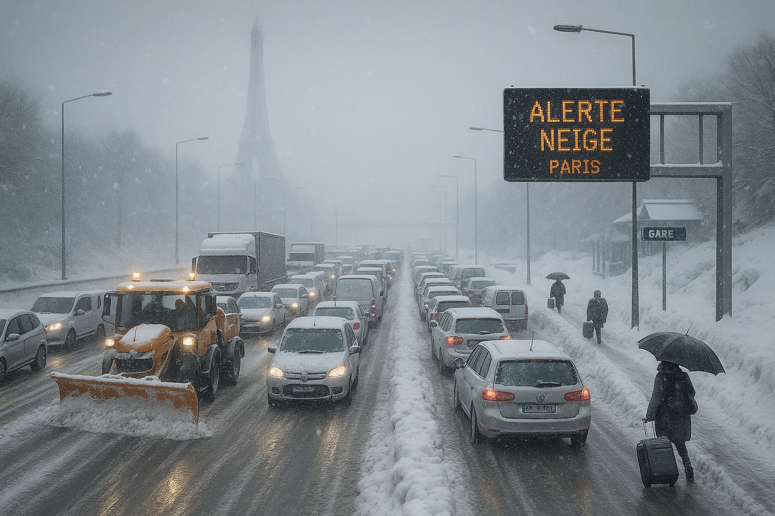
Severe snow and ice storm disrupts traffic on a French highway near Paris, with stuck cars, accidents, and emergency response amid orange weather alert.
AI에 의해 생성된 이미지

Snow and ice cause major disruptions in France

AI에 의해 생성된 이미지

An intense snow offensive hits France on Wednesday, with 38 departments on orange alert for snow and ice. Transport Minister Philippe Tabarot advises avoiding travel in Île-de-France and favoring telework. Deadly accidents and transport disruptions already mark the current episode.

France faces a major new snow episode on Wednesday, January 7, 2026, following more intense falls than expected in recent days. According to Météo-France, 38 departments, from Poitou-Charentes to the Belgian border via Centre-Val de Loire and Île-de-France, are on orange alert. Forecasts predict 3 to 6 cm of snow on average, up to 8-10 cm locally in Hauts-de-France and Ardennes, with ice risk on frozen ground.

Transport Minister Philippe Tabarot acknowledged in a press conference that «the episode turned out more significant than expected, with up to 8 cm in places». He urged limiting travel, emphasizing telework in Île-de-France where speed will be capped at 70 km/h and heavy trucks banned. Sanef, the highway operator, asks drivers to cancel trips.

Transports are severely disrupted. SNCF halts electric trains on several lines from 6am to noon and slows high-speed lines. Île-de-France Mobilités suspends school transport in four departments and expects bus stoppages. At Paris airports, 40% of flights are canceled at Charles-de-Gaulle and 25% at Orly from 6am to 2pm for snow removal.

The episode has already caused five deaths: three in Landes from two ice-related accidents on A63 and RD824, and two in Île-de-France, including a VTC driver. An interministerial crisis cell, chaired by Interior Minister Laurent Nuñez, coordinates responses. About 6,100 households are without power in Pays de la Loire, and electricity consumption exceeded 90 GW, a rare peak.

Despite persistent cold since Christmas, experts like Régis Crépet from La Chaîne Météo note it's a «sustained cold peak» not a national cold wave, though regional waves affect the East and Center-East.

사람들이 말하는 것

X discussions focus on severe transport disruptions from snow and ice across 38 departments under orange alert, including flight cancellations, train suspensions, and massive traffic jams in Île-de-France. Users criticize government and infrastructure unpreparedness despite forecasts, mocking paralysis from minimal snow accumulation and questioning where tax money goes. Comparisons to better-managed northern European countries highlight perceived incompetence. Official accounts from Météo-France, prefectures, and transport operators urge limiting travel, teleworking, and caution. Some express skepticism about Île-de-France's vulnerability compared to other regions.

관련 기사

Snow-covered Paris highway gridlocked with stranded vehicles during France's intense cold wave, Eiffel Tower in snowy background.
AI에 의해 생성된 이미지

France cold wave: Widespread transport chaos as snow blankets west and Paris region

AI에 의해 보고됨 AI에 의해 생성된 이미지

Following initial alerts and school closures in western France, the polar cold wave intensified on January 5, 2026, blanketing the west and Paris basin with heavy snow. Twenty-six departments on orange alert faced massive road, rail, and air disruptions, with authorities warning of slippery roads persisting into Tuesday.

The snow and freezing rain episode, ongoing since January 5, 2026, intensified across northern and western France on January 7, leading to severe transport disruptions and record emergency room visits for ice-related injuries. Following initial orange alerts for 38 departments, Météo-France reduced them to 12 as accumulations hit 3-7 cm (up to 10 cm locally). Transport Minister Philippe Tabarot criticized forecast underestimations amid the chaos.

AI에 의해 보고됨

Eight French departments have been placed on snow and black ice alert due to an expected weather perturbation starting from midnight Sunday. The regions of Brittany and Normandy have announced the suspension of school transports for Monday, January 5. Snowfalls of 3 to 7 cm are forecast, with circulation difficulties expected.

Storm Goretti is approaching from the Atlantic and threatens northern France starting Thursday, January 8, 2026. Gusts up to 140 km/h are expected, with orange vigilance for four departments. The Normandy coasts and Opal Coast will be most exposed to strong winds and waves of 5 to 6 meters.

AI에 의해 보고됨

A heavy snowstorm has moved into Skåne from Germany on Monday, with SMHI issuing an orange warning for up to 30 centimeters of snow in the southeast. Public transport is canceled and authorities urge people to stay home. Preparations have been strengthened following past chaos.

Following earlier DGT warnings of snowfalls, 11 roads are now closed due to snow and ice storms affecting 41 routes across Andalucía, Asturias, Castilla y León, and Navarra on December 25. Aemet alerts cover six communities for snow, low temperatures, rough seas, and rain, as 8.5 million trips occur in the ongoing special traffic operation.

AI에 의해 보고됨

Depression Ingrid, which caused intense rains, strong winds, and flooding in Brittany, is losing intensity on Saturday, but flood risks persist due to saturated soils. Orange flood alerts remain in place for Finistère, Morbihan, and Ille-et-Vilaine. In Quimperlé, a very slow decline is expected after a new flood peak.


이 웹사이트는 쿠키를 사용합니다

사이트를 개선하기 위해 분석을 위한 쿠키를 사용합니다. 자세한 내용은 개인정보 보호 정책을 읽으세요.
거부