Sierra snowpack drops but reservoirs remain full

The Sierra Nevada snowpack has fallen to 59% of its historical average after weeks of sunny weather following Christmas storms. Experts note that full reservoirs and the remaining winter months mitigate concerns. Ski resorts continue to operate smoothly with artificial snow support.

The Sierra Nevada snowpack, vital for nearly one-third of California's water supply, peaked at 93% of average on January 6 after heavy Christmas Eve storms dumped 7 to 8 feet of snow in the Lake Tahoe area. However, three weeks of warm, sunny conditions have reduced it to 59% by January 29, with meteorologist Jan Null reporting 23 days without significant storms and none forecast for the next week.

Despite the decline, experts emphasize it's not alarming. The past three winters brought above-average precipitation, ending the 2020-2022 drought and filling reservoirs. Shasta Reservoir rose 36 feet between mid-December and early January, reaching 80% capacity or 125% of normal. Oroville climbed 69 feet to 82% full, or 138% of normal, while San Luis stands at 77% (105% normal) and Diamond Valley at 95%.

"It would be a different conversation if the reservoirs were below average," Null said. Winter precipitation typically peaks in December through March, leaving ample time for recovery. Ski industry leader John Rice called it "only the fourth inning," noting the Christmas "miracle" storms built a solid base for resorts, supplemented by snowmaking. No part of California faces drought, per the U.S. Drought Monitor, unlike much of the West.

A high-pressure ridge off the coast has diverted storms northward, but forecaster Bryan Allegretto sees potential for wetter patterns by mid-February. On January 30, the Department of Water Resources will conduct a snow survey at Phillips Station near Sierra-at-Tahoe. While low snow could raise wildfire risks if dry weather persists, current conditions support water security and recreation.
ተያያዥ ጽሁፎች

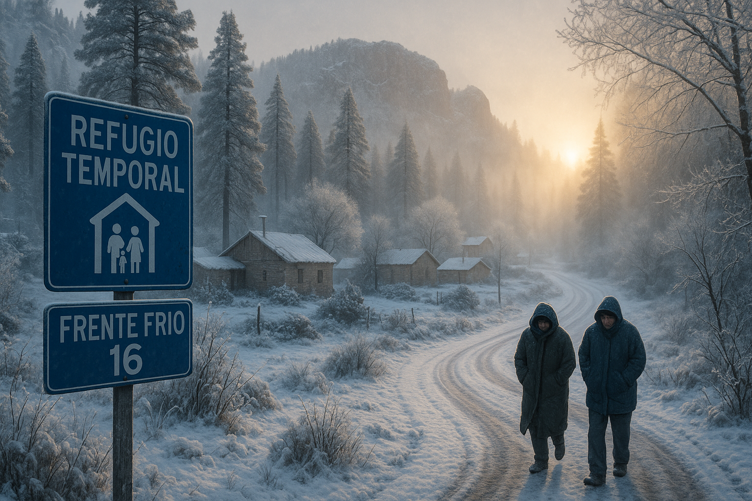
First snowfall blankets La Rosilla amid -11.5°C cold from Front Frío 16, with shelters activated.
በ AI የተሰራ ምስል

First snowfall of season blankets Ensenada and La Rosilla

በAI የተዘገበ በ AI የተሰራ ምስል

The first snowfall of the 2025-2026 season fell in Ensenada, Baja California, and La Rosilla, Durango, during the early mornings of November 20 and 21, driven by Front Frío 16 and the first winter storm. Temperatures dropped to -11.5 °C in La Rosilla, blanketing areas with up to two centimeters of snow. Authorities activated alerts and shelters amid the extreme cold.

After a snowless start to the week, flakes fell on Thursday across all French massifs. Forecasts predict abundant snowfall until Sunday, heralding a prosperous winter for mountain resorts. From Val d'Isère to the Pyrenees, professionals are delighted by this timely return.

በAI የተዘገበ

An atmospheric river unleashed historic flooding in Washington state starting December 8, prompting a state of emergency and evacuations for 100,000 people. Low snowpack and burn scars from recent wildfires exacerbated the deluge, linking the event to climate change. Officials warn of more rain from additional storms this week.

Iran’s capital is confronting a worsening water crisis after officials warned the main reservoir has roughly two weeks of supply left. President Masoud Pezeshkian said that if rains do not arrive soon, Tehran will begin water rationing and, if drought persists, could be forced to evacuate parts of the city.

በAI የተዘገበ

São Paulo's main reservoir system, Cantareira, saw a 0.1% drop in stored volume on January 1, 2026, reaching 20.1%, despite recent rains. This triggered the 'restriction' level, capping water withdrawals at 23 cubic meters per second, supplemented by the Rio Paraíba do Sul. Officials state there is no immediate risk of water rationing.

The State Meteorological Agency (Aemet) has activated yellow warnings for rain, snow, wind, and waves in seven provinces for this Saturday, January 3, 2026, while an Arctic air mass will arrive on Sunday, bringing snow at low altitudes and intense cold until Epiphany.

በAI የተዘገበ

Kenya's Meteorological Department has issued a weather forecast from January 17 to 21, predicting occasional afternoon showers in Nairobi and other areas while much of the country remains hot and dry. Strong winds are also expected in several regions. Residents are advised to prepare for these changes.


ይህ ድረ-ገጽ ኩኪዎችን ይጠቀማል

የእኛን ጣቢያ ለማሻሻል ለትንታኔ ኩኪዎችን እንጠቀማለን። የእኛን የሚስጥር ፖሊሲ አንብቡ የሚስጥር ፖሊሲ ለተጨማሪ መረጃ።
ውድቅ አድርግ